
WWII B-17 Flying Fortress 8th Air Force Navigator Map USAAF History Gift Display For Sale

When you click on links to various merchants on this site and make a purchase, this can result in this site earning a commission. Affiliate programs and affiliations include, but are not limited to, the eBay Partner Network.

WWII B-17 Flying Fortress 8th Air Force Navigator Map USAAF History Gift Display:
$110.00
Comes with a hand-signed C.O.A. and a full historical research write-up.*Limited Edition of 50*
Due to an incredibly high demand for our display case options, we are proud to offer one of our LIMITED EDITION series of HISTORIC DISPLAY CLEAR DISPLAY STAND EXCLUSIVES! This incredible “Piece of History“ is professionally encased in a clear display case with an added FREE display stand included.
Each display features a historical photograph and a short description that corresponds to the piece of history displayed. The display and stand together measure approximately 5.5 inches tall by 4 inches wide making it the perfect size to fit on any desk or inside any display case!
This series is a limited edition of 50 pieces, meaning that each “Piece of History” display is unique. The WWII 8th Air Force B-17 Flying Fortress piece of history you receive may vary just slightly from the display shown.
This incredibly rare and very historic piece of WWII history is an original U.S. 8th Air Force ETO navigational mission map that was used by a B-17 Flying Fortress navigator during WWII.
The United States Army Air Forces (USAAF) B-17 Flying Fortress relied heavily on these navigational maps as they were critical tools that guided B-17 crews through the complexities of their missions.
The development of navigational maps for B-17 crews was a multifaceted process that involved cartographers, intelligence officers, and aviators. These maps needed to be highly detailed, providing comprehensive information on terrain, landmarks, and friendly airfields. Cartographers meticulously compiled data from various sources, including aerial reconnaissance, geographical surveys, and intelligence reports, to create maps tailored to the needs of B-17 navigators and their missions.
These maps were utilized in the 8th Air Force pre-mission briefings, multiple times during the missions themselves, and post-mission briefing reports!
The navigational maps used by B-17 navigators of the 8th Air Force played a vital role in the success of Allied air campaigns. By providing accurate guidance through airspace, these maps contributed to the precision and effectiveness of missions, ultimately contributing to the Allied victory in World War II.
This would make an amazing addition to any WWII or Air Force collection.
Related Items:
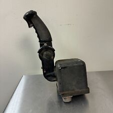
WWII Era US Army Air Forces C-1 Auto Pilot Formation Stick B-17, B-24, and B-29
$278.95
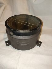
Antique Rare WWII USAF/Army B17 Compass Type D-12 Made By Bendix Aviation Corp.
$350.00
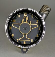
WWII USAF B-17 B-24 Heavy Bomber Sperti Inc Ball Turret Azimuth Position Gauge
$480.00