
Antique 1887 Map, Commerce of the World, Ocean Currents, Wind Zones, & Commerce For Sale

When you click on links to various merchants on this site and make a purchase, this can result in this site earning a commission. Affiliate programs and affiliations include, but are not limited to, the eBay Partner Network.

Antique 1887 Map, Commerce of the World, Ocean Currents, Wind Zones, & Commerce:
$18.95
Antique 1887 Map, Commerce of the World, Ocean Currents, Wind Zones, & Commerce[WRN 1887.worldc] THANK YOU FOR YOUR INTEREST!
AUTHENTICITY:This is an authentic historic print, published on the date stated above. I do not offer reproductions. It is not a modern copy. The term 'original' when applied to a print means that it was printed at the first or original date of publication; it does not imply that the item is unique. 'Print' means any image created by applying an inked block to paper or card under pressure by any method including wood engraving, steel engraving, copperplate, wood cut and lithography.
PAGE DIMENSIONS:19 3/16" wide x 11¾" tall
MAP DIMENSIONS: 14¾" wide x 8 7/8" tall
CONDITION:Good. This item is printed on book page stock and has images and/or text on the reverse.The image shown in the main photo is the print that is offered for sale. You may decide to use the image on the reverse, so photos of the reverse side are included. It was carefully removed from a book/magazine that was too flawed to sell whole. Please note any other blemishes on the scan prior to purchasing this picture. Virtually all antiquarian maps and prints are subject to some normal ageing due to useand time which is not obtrusive unless otherwise stated. Ageing usually takes the form of darkening of the paper, known as toning, and might be visible throughout or only on the edges. Other age-related discrepancies may include minor creases, slightly rounded corners of the page, indented or uncentered margins. This print has ample margins, the gutter is intact showing the original holes from sewn binding or staple binding. This is a two-page map, attached to a binder strip by the printer for insertion into the manuscript.
TITLE: Commerce of the United States
SOURCE: Warren's Common-School Geography, New England Edition, 1887, Cowperthwait & Co. Phil
STATE(s): n/a
COUNTRY: world
SURVEYED: Unspecified
PRINTED: 1887 on thick paper stock
SCALE: unspecified
ORIGINAL ARTIST/ENGRAVER: Unspecified (Probably -Matthews, Northrop & Co., (Engr's) N.Y.
TYPE: Chromolithograph from engravings
ADDITIONAL HISTORY:
I have more unique maps currently available with many being listed every week, so check back and feel free to follow my store. Got Questions? Please feel free to ask any questions you have regarding any item, and I will respond quickly.
response: I always leave response after the transaction is complete. However, if I haven't received response from you, how am I to know if you are satisfied with your purchase. Please leave response to verify a complete transaction, and I'll be happy to return the favor.
Please Contact Me
Please contact me if you have any problems with your purchase, no matter how small, after its receipt because I will want to make it right as soon as possible.
This map comes from a smoke-free, fragrance-free, & pet-free environment.
THANK YOU FOR VISITING!
Related Items:
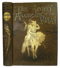
1887 VERY RARE ANTIQUE AMERICAN INDIAN BOOK ILLUSTRATED TRIBES MASSACRES WAR US
$2395.00
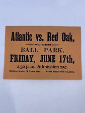
Antique 1887 Iowa Local Baseball Game Hand Bill Atlantic V. Red Oak June 17th
$175.00

Antique 1887 Powell Bishop & Stonier PB&S Oriental Chatsworth Design Jug
$161.06